Pictured Rocks National Lakeshore MI
Lat, Long: 46.56435642, -86.31628733
Designation: National Lakeshore
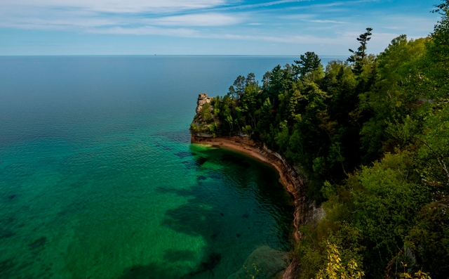
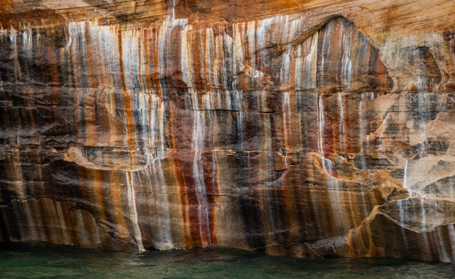
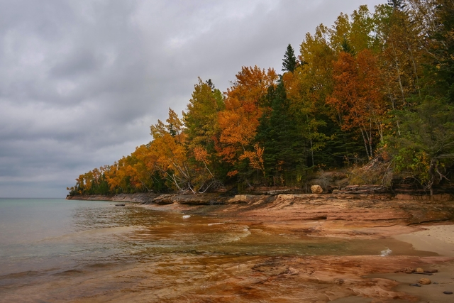
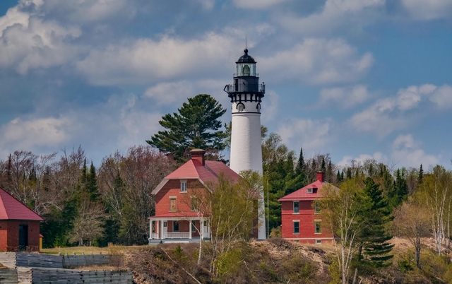
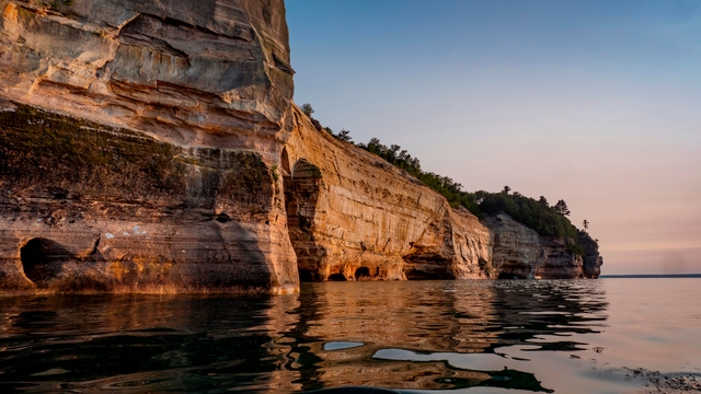
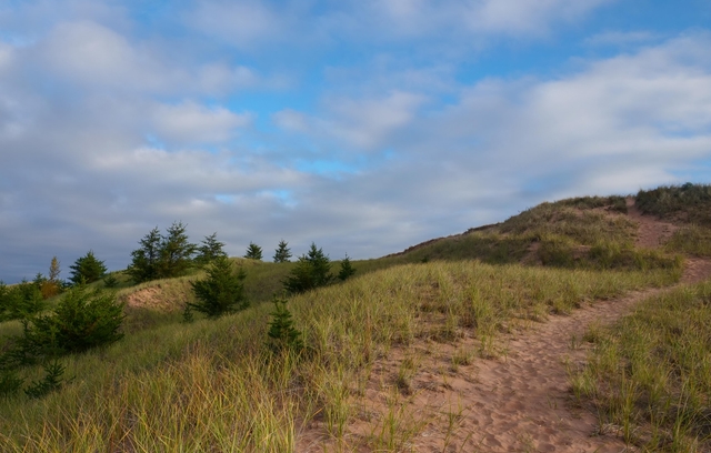
Sandstone cliffs, beaches, waterfalls, sand dunes, inland lakes, deep forest, and wild shoreline beckon you to visit Pictured Rocks National Lakeshore. The power of Lake Superior shapes the park's coastal features and affects every ecosystem, creating a unique landscape to explore. Hiking, camping, sightseeing, and four-season outdoor opportunities abound.
Weather:
Summers are pleasant with the average highs in June, July, and August in the 70s°F, and lows in the low 50s°F. The coldest months are December through March with average highs of 25°F to 32°F, and average lows in the teens. Annual precipitation averages 31 inches; average annual snowfall is about 140 inches, although winters with more than 200 inches are not uncommon. Snow generally covers the ground from late November through late April.
Directions:
Pictured Rocks NL is located on the south shore of Lake Superior in Michigan's Upper Peninsula, between the towns of Munising (west) and Grand Marais (east). Access the west side of the park via Michigan highways M-28 and M-94 to Munising. State highway M-77 leads to Grand Marais on the east side. Alger County Road H-58 runs parallel and through the park, providing access to spur roads that lead to scenic overlooks, trailheads, campgrounds, beaches, etc. Most park roads are closed in winter due to snow.
For more details ›Address/Contact:
1505 Sand Point Road
Munising, US, 49862
Phone: 906-387-3700
Email: piro_information@nps.gov
Entrance Fees:
Entrance - Private Vehicle
$25.00
This pass admits the driver and all passengers in a private-use vehicle for seven consecutive days to all areas of Pictured Rocks National Lakeshore. This fee does not cover additional fees associated with activities such as camping or commercial tours.
Entrance - Motorcycle
$20.00
Valid for 7 days. Admits up to 2 private, non-commercial motorcycles with up to 4 total passengers to all areas of Pictured Rocks National Lakeshore. This fee does not cover additional fees associated with activities such as camping or commercial tours.
Entrance - Snowmobile
$15.00
This pass admits a snowmobile to all parts of Pictured Rocks National Lakeshore for 7 consecutive days. This fee does not cover additional fees associated with activities such as camping or commercial tours.
Entrance - Per Person
$15.00
This pass admits one walk-in, bicycle-in, or boat-in person to all parts of Pictured Rocks National Lakeshore. This fee does not cover additional fees associated with activities such as camping or commercial tours.
Commercial Entrance - Sedan
$25.00
This admits a commercial sedan to all areas of Pictured Rocks National Lakeshore. The flat rate for this pass is $25, plus an additional $5 per person age 16+. This fee does not cover additional fees associated with activities such as camping or commercial tours.
Commercial Entrance - Van
$40.00
This pass admits a commercial van with a capacity of 7-16 persons, regardless of capacity, to all parts of Pictured Rocks National Lakeshore. This fee does not cover additional fees associated with activities such as camping or commercial tours.
Commercial Entrance - Mini-bus
$40.00
This fee admits a commercial mini-bus to all parts of Pictured Rocks National Lakeshore. A mini-bus is defined as a vehicle with a 16-25 person capacity. The fee is charged regardless of occupancy of the vehicle. This fee does not cover additional fees associated with activities such as camping or commercial tours.
Commercial Entrance - Motor Coach
$100.00
This fee applies to commercial vehicles with a 26+ person vehicle capacity, regardless of occupancy. This fee does not cover additional fees associated with activities such as camping or commercial tours.